
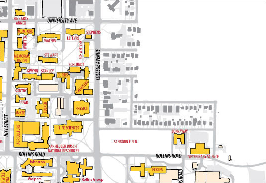
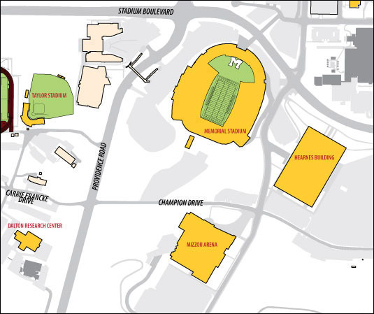
Brick & Mortar Project Map
Move cursor over a building on the map to see the name of the building. Click on a building and you will be directed to its main page.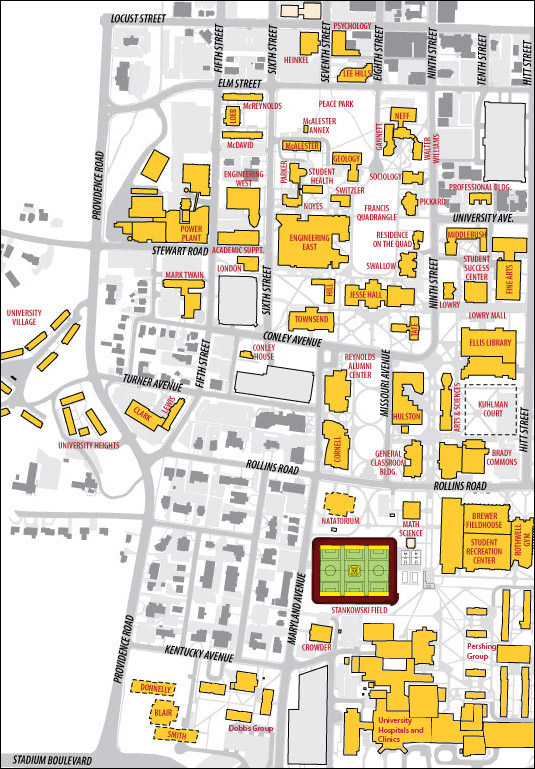
Not pictured:
- Bingham Group (located on College Avenue just south of Eckles Hall)
- Trowbridge Livestock Center (located on Ashland Road)
- Academic Hall (destroyed by fire in 1892)
- Benton Hall (previously located near present-day Townsend Hall, demolished in 1925)
- Lathrop Hall (previously located on 6th Street near present-day Lafferre Hall, demolished in 1961. This was the first Lathrop Hall on campus, the second being part of the Dobbs Group.
- Confederate Rock (presently located on Boone County Courthouse lawn)
- G.I. City (term refers to surplus barracks, trailers, and other buildings on campus)
- Laws Observatory (previously located near present-day Neff Hall, demolished in 1919)

This project was originally developed with support from the Institute of Museum and Library Services under the provisions of the Library Services and Technology Act as administered by the state of Missouri.